🌿 Pilot Site

Conservation & Protection

Using smart sensors and AI, we protect rare medicinal plants and superfruits threatened by climate change and overharvesting across Nainital's diverse elevation zones.

Our Impact Conservation Approach
🌿 Project Impact

Our Conservation Impact

The Smart Sensor Mapping System pilot in Nainital has already made measurable differences in conservation outcomes.

150+

IoT Sensors Deployed

Across Nainital District's 7 distinct elevation zones

15

Endangered Species

Actively monitored with real-time sensor data

100+

Partner Communities

Van Panchayats and institutions collaborating

29%

Species Now Rare

Wild edibles in Nainital foothills categorized as Rare

IoT Sensor deployment
🌿 IoT Infrastructure

Sensor Network

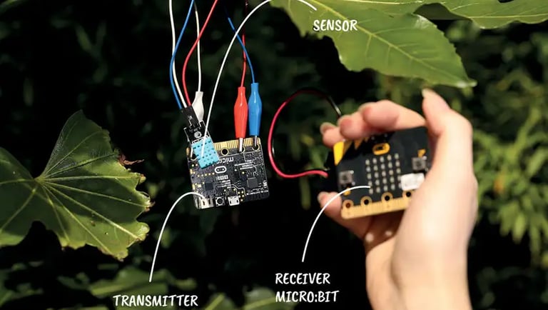
Our IoT sensors monitor soil moisture and GPS locations, feeding real-time data to AI systems that identify and map medicinal plants like Jatamansi and Kutki across Bhimtal and Haldwani.

🌡
Soil & Temperature Sensors

Track micro-climates where rare species thrive — soil moisture, UV index, and ambient temperature

📍
GPS Node Clusters

Each rare flora cluster geo-tagged to prevent illegal poaching and monitor seasonal growth patterns

📈
Predictive Analytics

Historical data and sensor inputs used to predict future herb hotspots and emergence patterns

📶
Wireless Sensor Networks (WSN)

Seamless data transmission from remote forest areas to central GIS dashboard
🌿 Species Status

Conservation Status Graph

The data collected by our sensors indicates that while many species are "Common" (35%), nearly 29% of wild edibles in the Nainital foothills are now categorized as "Rare" due to human encroachment.

Critically Endangered
Rare
Endangered
Common
Common Species35%
Rare Species29%
Endangered22%
Critically Endangered14%
Conservation Status Graph Jatamansi herb
🌿 Community Engagement

Community Rangers

Local rangers use field apps to input observations and help track hotspots, ensuring sustainable harvesting and conservation efforts remain grounded in real-world insights.

The pilot phase will act as a model for scaling this system to other districts in Uttarakhand, eventually covering the entire state.

Data Collection Approach

01
Field Survey via Mobile App

Trained rangers use dedicated field apps to record herb sightings, GPS coordinates, and growth data

02
Smart Sensor Micro-Stations

IoT stations deployed at key sites collect environmental data automatically 24/7

03
Forest Ranger Collaboration

Direct partnership with forest department officials for on-ground verification

04
Van Panchayat Inputs

Community-based reporting ensures local knowledge enriches the scientific dataset

Smart sensor on tree Field ranger
🌿 Our Services

Conservation Services

📍

Real-Time Tracking

GPS tagging herbs for instant location updates and anti-poaching monitoring across all forest zones.

💧

Soil & Moisture Monitoring

Environmental conditions monitored 24/7 to support plant health and identify optimal conservation zones.

🧠

AI Species Identification

Advanced AI recognizes, catalogs, and monitors rare species with high accuracy across the region.